Dry River
Santa Ana, CA, USA
Panoramic photo collage with Kodak Type-C prints
1990
17 x 66
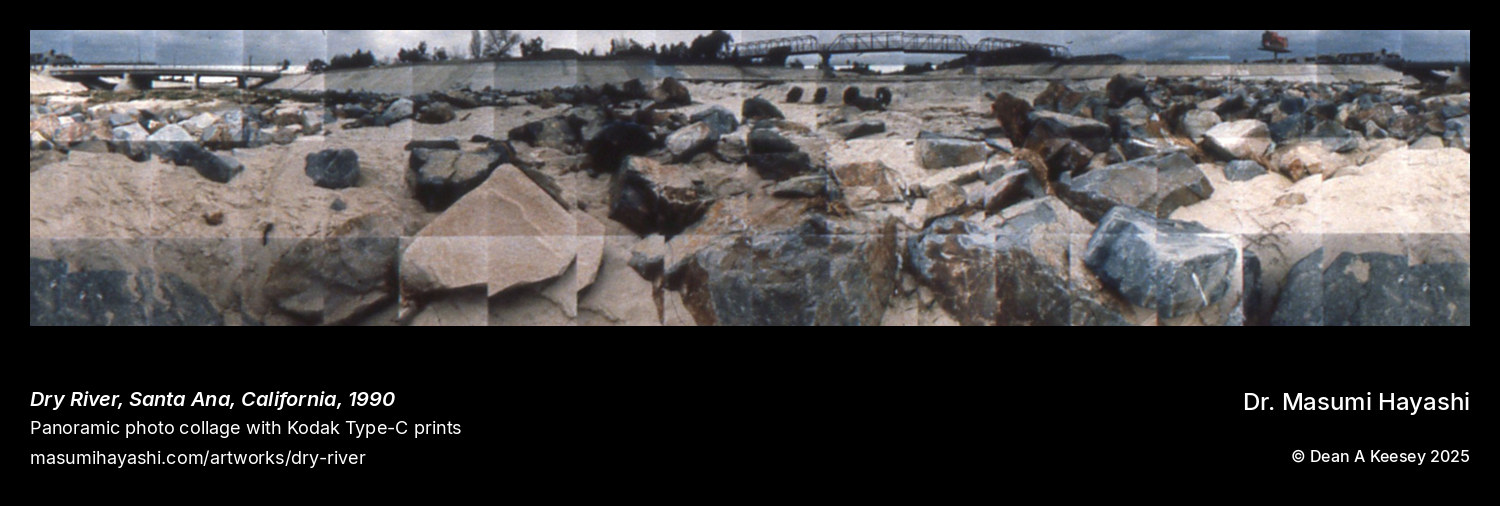
This 17-by-66-inch horizontal panorama documents a dry riverbed in Santa Ana, California—the channelized waterway that Southern California’s infrastructure has transformed from natural stream to concrete flood control channel. The nearly five-and-a-half-foot width captures the linear geometry of engineered drainage that has replaced natural hydrology throughout the Los Angeles Basin.
Created in 1990, the work documents the characteristic Southern California treatment of rivers: containment within concrete channels that efficiently move storm water while eliminating the natural riparian environment. The Santa Ana River and its tributaries have been progressively channelized since the early twentieth century, occasional catastrophic floods driving investments in infrastructure that transformed living waterways into engineered drains.
The “dry river” designation captures the paradox of Southern California’s relationship with water: rivers that flow only during storms, their channels empty for months while drought-adapted urban development surrounds them. The concrete channel awaits seasonal floods while remaining eerily vacant between rain events—infrastructure designed for emergencies rather than daily life.
The extreme horizontal format emphasizes the channel’s linear extent, the compositional proportions matching the engineered geometry of flood control. The photo collage technique fragments this utilitarian infrastructure while revealing the formal qualities of concrete surfaces designed purely for hydraulic efficiency.
This documentation connects to Hayashi’s broader interest in landscapes shaped by industrial and engineering processes. The channelized river represents a different kind of post-industrial intervention: not the collapse of manufacturing but the transformation of natural systems into engineered infrastructure serving urban development.